



Bribie Island Flight Path Proposal Centres On Northern Communities 

For communities around Caboolture and southern Bribie Island, a proposed Bribie Island flight path change could alter where Brisbane Airport arrivals travel across northern Moreton Bay. 


The proposal forms part of Package 3 of the Noise Action Plan for Brisbane, which examined options to reduce the frequency and concentration of aircraft movements over Greater Brisbane communities.

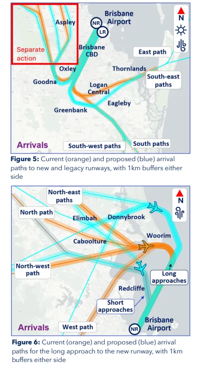
Maps comparing the current and proposed northern arrival routes place Caboolture within the wider flight path area, alongside Elimbah, Donnybrook, Woorim and Redcliffe. No separate estimate has been published for the number of Caboolture residents who may be affected by the change.

Southern Bribie Island has a more specific connection to the plan. One of the progressed Package 3 actions is intended to move over-water arrivals away from the southern end of the island, where aircraft have travelled at lower altitudes on their approach to Brisbane Airport.

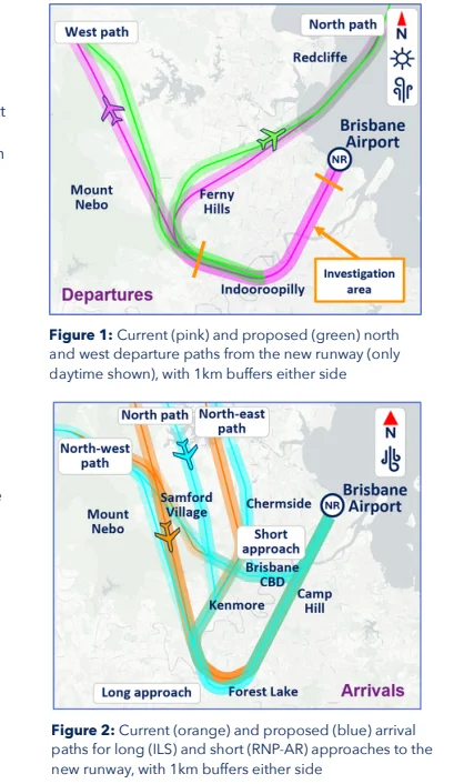
Caboolture marked within proposed aircraft flight paths
Photo Credit: Airservices Australia

Bribie Island Flight Path Awaits Assessment

The proposed northern routes would shift arrivals further north over water before aircraft line up with the northern end of Brisbane Airport’s new runway.

Airservices Australia estimates the revised paths would reduce the number of people overflown from the north and west over water by about 59,000. However, the design would also place about 6,000 additional people beneath the final turn over land because the approach connection must be extended to comply with aviation requirements.

The Bribie Island flight path change has not begun operating. It remains subject to a Civil Aviation Safety Authority Airspace Change Proposal and cannot be introduced until that assessment is completed.

This differs from changes to arrivals over land at the southern end of Brisbane Airport’s runways, which commenced on 9 July 2026. Those routes did not require further design review or additional approval.

Aircraft travelling over the Bribie Island coastline
Photo Credit: Airservices Australia

Different Approaches For Non-Jet Aircraft

Package 3 also progressed short-approach connections for non-jet aircraft using the northern runway end.

These connections would allow non-jet arrivals to be divided between long and short approaches over water. Aircraft using a shorter approach would turn and align with the runway closer to the airport, providing another route for distributing flights.

Bribie Island flight path
Photo Credit: Airservices Australia

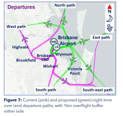
The change is also intended to reduce the impact of visual arrivals over Redcliffe. A separate proposed adjustment to non-jet departures was not progressed because it was not expected to produce a meaningful noise difference and could restrict jet departures using the same runway.

Airservices Australia
Photo Credit: Airservices Australia

Wider Changes Remain Contested

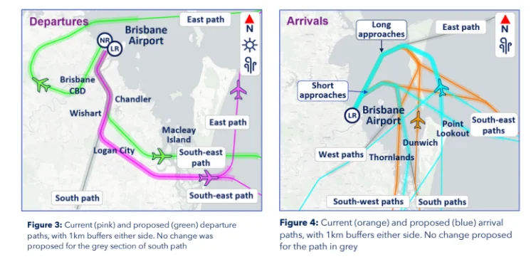
Across the wider package, Airservices Australia estimates almost 140,000 fewer residents would be directly overflown through northern and southern arrival changes and an adjustment to south-east departures.

The Brisbane Flight Path Community Alliance disputes that figure. The group argues it is based on estimated populations within modelled flight path corridors rather than measured aircraft noise, flight frequency, night-time disturbance or cumulative exposure.

It has also criticised the absence of a curfew, flight cap, guaranteed over-water operations and enforceable noise limits from Package 3.


The changes are also designed to support Independent Parallel Runway Operations, allowing aircraft to land on both Brisbane Airport runways at the same time during busy daytime periods. Regular use of that system is not expected until mid-to-late 2027.

Feedback on the Package 3 reports remains open until 23 August 2026.

Published 15-July-2026
The Belvedere Hotel Reaches 125-Year Milestone In Woody Point

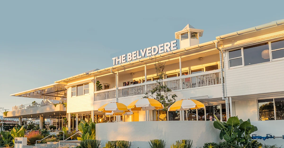
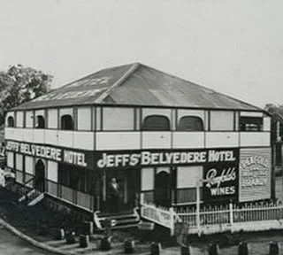
The Belvedere Hotel in Woody Point has marked 125 years since becoming a hotel in 1901, having served generations of patrons through local celebrations, meetings and community events.


Early Years At Woody Point

The property began as a boarding house during the 1890s before Thomas and Mary Snook converted it into a hotel in 1901.

It has remained on the Redcliffe Peninsula through decades of change, with its waterfront position and sunset views continuing to form part of the venue’s identity.

General manager Mitchell Paul attributed its longevity to the location, customer service and the hotel’s ability to adjust its menu and hospitality offering as customer expectations changed.

Patrons have travelled from areas between the Sunshine Coast and Gold Coast to meet friends and family at the venue. During its anniversary period, the hotel also published historical photographs showing how the property had developed and invited visitors to share their own memories.

Belvedere Hotel building at Woody Point
Photo Credit: The Belvedere/Facebook

Generations Of Community Gatherings

Across its history, the hotel has been used for family birthdays, Christmas gatherings, dinners, work lunches, staff meetings and special events.

It has also hosted trivia nights, fundraisers, service-club meetings, school reunions and business networking events, making it a regular setting for both personal occasions and organised community activities.

The venue sponsors local sporting clubs and has supported Raise it for Redcliffe Hospital since at least late 2020.

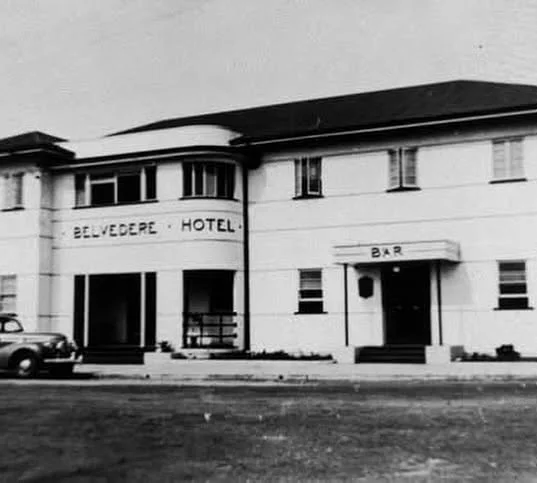
The Belvedere Hotel during the 1930s
Photo Credit: The Belvedere/Facebook

That involvement has included hosting events, matching Giving Day gifts as an Impact Partner and contributing to Christmas initiatives for children receiving hospital care.

Management has identified community, identity and staff development as priorities for the hotel’s future. The venue also has a history of promoting employees internally, allowing staff familiar with its operations to progress into leadership positions.

Woody Point hotel building in the 1950s
Photo Credit: The Belvedere/Facebook

The Belvedere Hotel Changes With The Peninsula

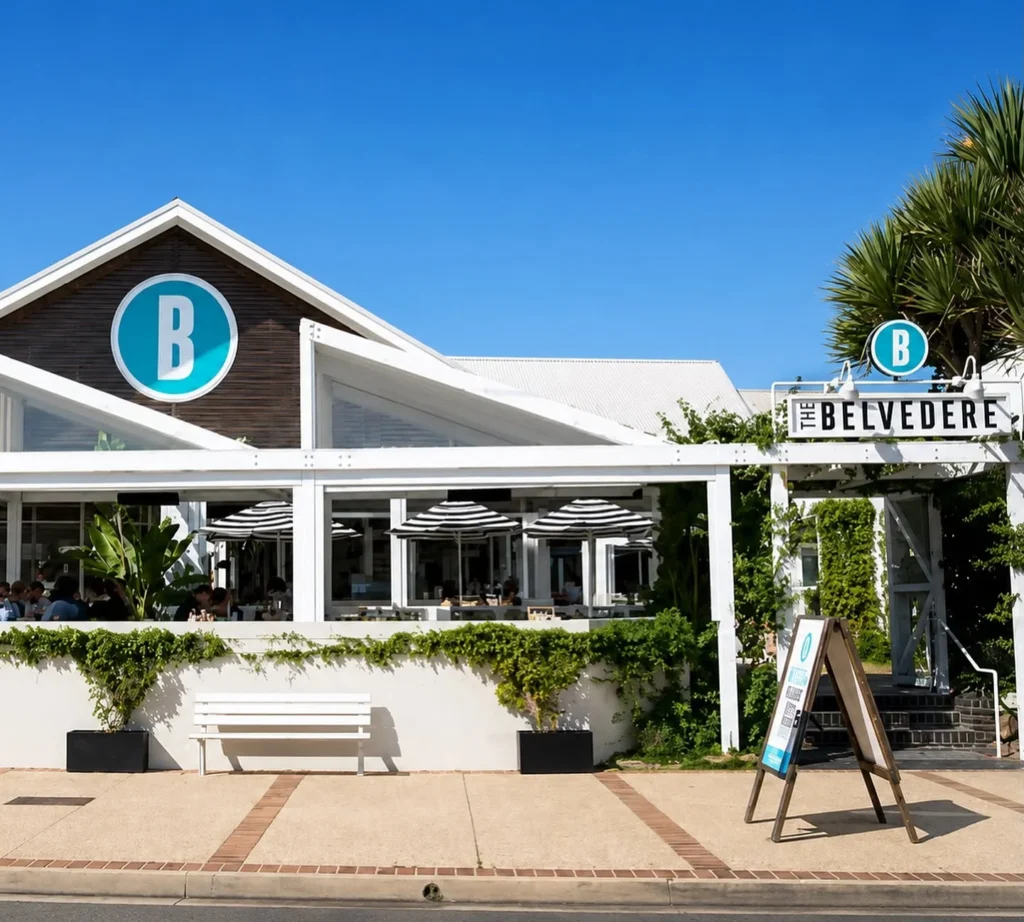
Lewis Land Group completed a large-scale renovation of the property in November 2023.

The facade, turret and original structure were retained, while newer sections were constructed around them. The work replaced several smaller spaces with a more open design connecting indoor and outdoor areas.

Capacity increased from about 700 patrons to 1,500 following the renovation. The expanded operation employs more than 200 staff during peak periods and prepares more than 10,000 meals each week.

The larger venue also allowed the hotel to accommodate demand that could not previously be serviced, including increased trade during occasions such as Mother’s Day.

The hotel scheduled a day-long community celebration for Saturday, 27 June as part of its 125th anniversary activities.


Plans released ahead of the event included live entertainment, family-friendly activities, giveaways, earlier menu favourites, a ceremonial birthday cake cutting and a digital photo booth at the Woody Point venue.

Published 3-July-2026
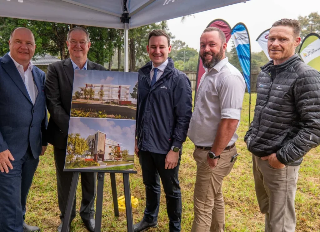
Morayfield Housing Development Moves Ahead On Oakey Flat Road

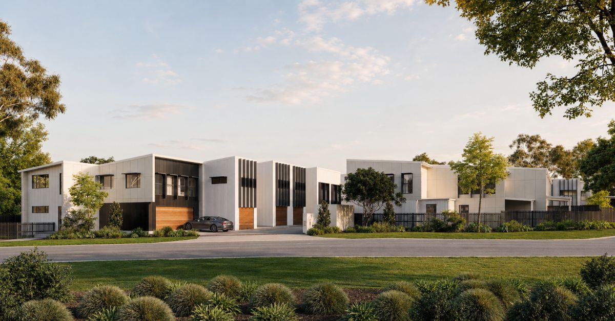
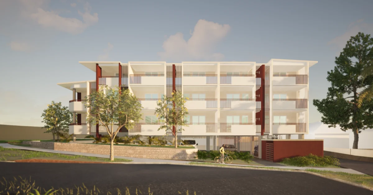
A 14-unit community housing development on Oakey Flat Road in Morayfield has moved ahead, with Murphy Builders appointed to deliver the long-term housing complex.


The project will provide a mix of one-bedroom, two-bedroom and three-bedroom units for eligible residents from the Queensland Housing Register. Future tenants may include seniors, families and people with disability.

Preliminary works are expected to begin soon, with construction expected to start later this year. The development is expected to be completed in late 2027.

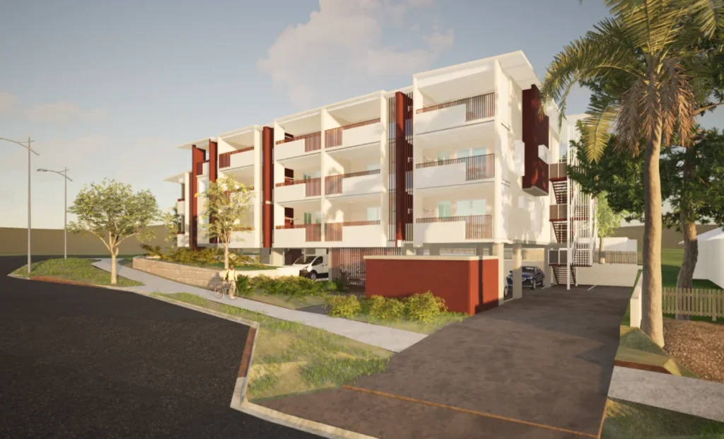
Oakey Flat Road housing
Photo Credit: Supplied

Oakey Flat Road Site Planned Near Transport And Shops

The Morayfield complex is planned for a site close to local transport and everyday amenities, including bus stops, Morayfield train station and shops.

The location places the planned homes near services used by residents in daily life, while keeping the development within the Morayfield area. The project has been designed as long-term housing for people who need safe and stable accommodation.

Alongside the 14 units, the development will include a community room within the complex. The space is intended for tenant activities, group meetings, small events and programs delivered by local service providers.

The mix of unit sizes means the complex will be able to accommodate different household needs. The one-, two- and three-bedroom homes will be part of a managed community housing site rather than short-term accommodation.

community housing
Photo Credit: Hollindale Mainwaring Architecture/Supplied

Coast2Bay Housing will develop and manage the site under a low-cost lease over land made available by City of Moreton Bay. Construction funding is being provided by the Queensland Government.

Murphy Builders’ appointment marks the next stage for the Oakey Flat Road project, following earlier planning for the site. Preliminary works are expected to start before the main construction phase begins.

Caboolture-Based Team To Support Tenants

Once the Oakey Flat Road complex is complete, Coast2Bay’s Caboolture-based team is expected to support tenants at the site.

The local team will be part of the ongoing management of the Morayfield development, with Coast2Bay to oversee the complex after construction is finished.

Coast2Bay Housing
Photo Credit: Hollindale Mainwaring Architecture/Supplied

The project is one of several community and affordable housing developments connected to the wider Moreton Bay area. A separate low-cost lease has also been granted for community housing at Caboolture.

Social and affordable housing projects are also under construction at Deception Bay and Mango Hill, while other projects remain under assessment.


For Morayfield, the focus is now on the Oakey Flat Road site, where the appointed builder, planned unit mix and expected construction timeline have set out the next steps for the development.

Published 15-June-2026
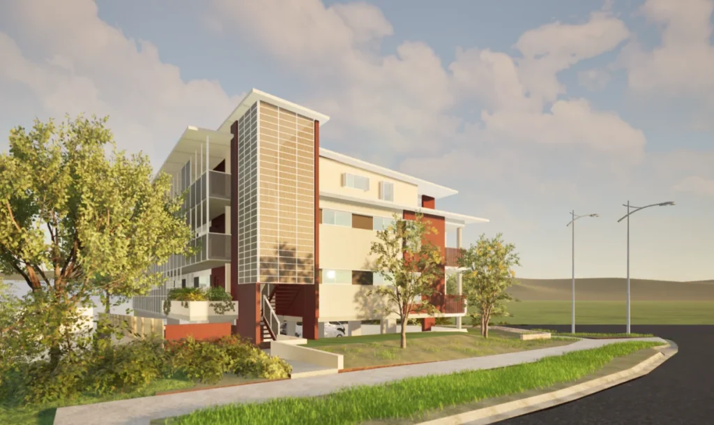
Photo Credit: Hollindale Mainwaring Architecture/Supplied

Morayfield and Burpengary Wetlands Win Recognition for Cleaning Stormwater

Across the City of Moreton Bay, a network of strategically positioned ponds, sediment basins, vegetated drains and native plantings is helping clean urban stormwater before it reaches local creeks and eventually Moreton Bay. These systems capture pollutants commonly found in runoff from residential and commercial areas, including sediment, nitrogen, phosphorus and other contaminants.

The region sits within the upper catchments of waterways that ultimately flow into Moreton Bay, meaning the quality of stormwater leaving suburbs such as Caboolture, Morayfield and Burpengary can have a measurable impact downstream.


Among the 90 constructed wetlands operating across the region, two projects close to home have received state-wide recognition for their innovative approach to stormwater management.

Two projects that raised the bar

At the 2025 Stormwater Queensland Awards for Excellence, two Moreton Bay constructed wetland projects took home top honours in their respective categories.

The Beech Drive Park Wetland Project in Morayfield was designed to improve water quality within the local catchment by capturing sediment and other pollutants before they enter downstream waterways. The project forms part of broader efforts to protect waterways flowing through the Caboolture region and into Moreton Bay.

Just south in Burpengary, the Crendon Street Park Naturalised Channel transformed a former concrete drain into a winding, vegetated waterway featuring sediment basins, habitat ponds and native plantings. The project now helps filter stormwater runoff while creating habitat for wildlife and enhancing a popular local park.

Both projects received honours at the 2025 Stormwater Queensland Awards for Excellence and showcase a growing shift towards nature-based infrastructure. Rather than relying solely on traditional concrete drains, these systems use wetlands, vegetation and natural water flows to improve water quality, support biodiversity and create more attractive public spaces for surrounding communities.

How constructed wetlands work

A constructed wetland is not a natural feature. It is an engineered system designed to mimic the pollutant-filtering function of natural wetlands, using sequences of ponds, sediment basins and densely planted vegetated zones to slow, settle and biologically treat stormwater as it moves through the system.

As water enters the first pond, heavy particles and sediment drop out. The water then moves slowly through vegetated zones where native aquatic plants and microbial activity in the root zone break down nutrients including nitrogen and phosphorus. By the time the water exits the system, the pollutant load has been substantially reduced before it reaches any natural waterway.

The thousands of native plants in these systems do more than treat water. They provide habitat corridors for birds, insects and small animals, reduce urban heat, and improve the amenity of the parks and reserves in which the wetlands are built.

Moreton Bay and what it’s worth protecting

Moreton Bay is a Ramsar-listed wetland of international significance, home to more than 700 species of marine life, internationally significant migratory shorebird populations, dugongs, dolphins and sea turtles. It supports both commercial and recreational fisheries and draws tourists and residents to the peninsula coastline year-round.

Urban stormwater is one of the most persistent sources of pollution entering the bay. Nutrients from household gardens, sediment from construction sites and fine particles from roads and paved surfaces all travel through stormwater drains and into creeks, which carry them to the bay.

Constructed wetlands intercept that flow at the catchment level, removing pollutants at scale before the water leaves the urban area.

For more information on Moreton Bay’s waterway programs, click here.


Published 8-June-2026

Featured Image Credit: City of Moreton Bay

Burpengary East’s Young Entrepreneur Turns Market Idea Into a Winning Success

A young business owner from North Harbour has earned recognition at the 2026 Redcliffe Business Awards, with Youngpreneur Markets by Chloe winning the Young Entrepreneur Award.


The award was presented during the Redcliffe Business Awards ceremony at The Komo on 28 May, where businesses from across the peninsula and surrounding communities were recognised for their achievements. Hosted by the Redcliffe Peninsula Chamber of Commerce and State Member for Redcliffe Kerri-Anne Dooley, the awards attracted 164 nominations across 10 categories.

For founder Chloe, the award highlights a business built around helping others take their first steps into entrepreneurship.

Creating a Space for Young Businesses

Youngpreneur Markets by Chloe was established to provide a platform for young entrepreneurs, small businesses and market stallholders to showcase their products and services.

The concept centres on creating accessible opportunities for people who may be starting a business for the first time, allowing them to connect with customers, gain experience and build confidence in a supportive environment.

Photo Credit: Youngpreneur Market by Chloe/Facebook

While many market events focus primarily on established operators, Youngpreneur Markets has developed a reputation for encouraging emerging business owners and giving them exposure to new audiences.

Its growth has helped create opportunities not only for its founder but also for the businesses that participate in the events.

Recognition Beyond Business Growth

The Young Entrepreneur Award recognises business owners aged between 12 and 25 who demonstrate initiative, innovation and leadership.

Organisers of the Redcliffe Business Awards describe the program as a celebration of the dedication, resilience and contribution of local businesses, with winners selected by an independent judging panel.

This year’s panel included Jodie Morphett from The Guides, Lawrence Gow from the Redcliffe Peninsula Chamber of Commerce and Gavin Daw from Bendigo Community Bank Margate.

Winning the category placed Youngpreneur Markets alongside businesses from a range of industries including tourism, hospitality, retail, health and community services.

Putting North Harbour on the Awards Map

Although many of this year’s winners were based on the Redcliffe Peninsula, Youngpreneur Markets by Chloe was the only award recipient from the Burpengary East and North Harbour area.

Photo Credit: Youngpreneur Market by Chloe/Facebook

The recognition shines a light on a growing part of the Moreton Bay region that continues to attract families, new residents and small business operators.

As the region grows, initiatives that encourage entrepreneurship among younger generations are becoming increasingly important. Businesses such as Youngpreneur Markets provide practical opportunities for aspiring entrepreneurs to test ideas, develop skills and gain firsthand experience in running a business.

The award also reflects the growing role young people are playing in the local business community, demonstrating that successful enterprises can be built at any age with determination, creativity and a willingness to take initiative.

Nominations for the 2027 Redcliffe Business Awards are expected to open in March next year.


Published 5-June-2026
Featured Image Credit: Youngpreneur Market by Chloe/Facebook

Cyclone-Damaged Dohles Rocks Seawall to Be Replaced Under Major Moreton Bay Project

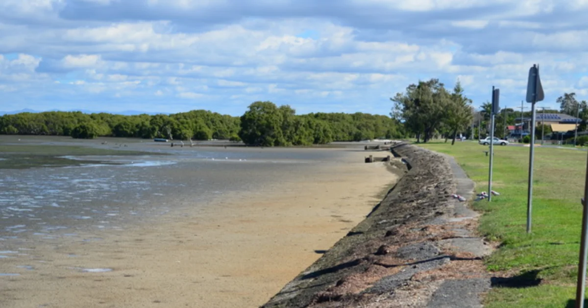
The Dohles Rocks Seawall, a decades-old barrier protecting the Pine River foreshore in Moreton Bay, is set to be completely rebuilt after years of deterioration and severe cyclone damage, with local residents now being asked to help decide where future access points to the waterfront should be located.


The existing seawall has protected the shoreline since the 1960s, but has steadily weakened due to age, tidal forces and coastal weather. Damage caused by Tropical Cyclone Alfred in March 2025 accelerated concerns about the structure’s condition, prompting plans for a full reconstruction project.

Community Input Sought Before Design Is Finalised

Moreton Bay Council has opened a public consultation process focused on one key question: where people should be able to access the water once the new seawall is built.

Photo Credit: City of Moreton Bay

Under the proposed design, the number of access stairs and small boat launch points along the foreshore will be reduced. Council representatives are seeking feedback from residents, fishers, boaters, walkers and other regular users of the area before detailed engineering plans are completed.

Community members are being encouraged to complete an online survey and identify preferred locations for access points using an interactive map. Feedback is being accepted until 4 p.m. on 29 June 2026.

The project team is also scheduled to meet residents during community pop-up sessions near the main boat ramp on 6 June and 10 June.

New Design Aims to Strengthen Erosion Protection

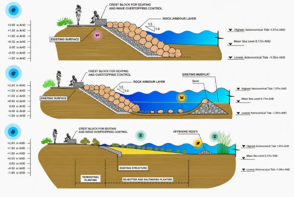
The reconstruction proposal centres on a rock armour seawall, a design commonly used in coastal environments to absorb wave energy and reduce erosion.

Council documents show the new structure would stretch about 540 metres along the foreshore, extending from the existing main boat ramp to the eastern end of Dohles Rocks Road. The seawall is expected to be between six and seven metres wide and include a concrete crest wall positioned above the rock structure.

Artists impression of the reconstructed seawall
Photo Credit: City of Moreton Bay

Project planners state the design was selected following an assessment of engineering, environmental and planning considerations. The preferred option was identified as a durable long-term solution capable of managing wave action and boat wake impacts while reducing future maintenance requirements.

Protection Against Erosion, Not Flooding

The reconstruction is intended to address coastal erosion affecting the foreshore and nearby public assets.

Council has stated that the seawall is not designed to protect the area from river flooding, storm tide inundation or long-term sea level rise. Instead, the project focuses on stabilising the shoreline and maintaining the safety and usability of the waterfront precinct.

Before the full reconstruction begins, temporary stabilisation works may still be carried out in sections considered most vulnerable. The current seawall will be demolished and removed as part of the project.


Construction is currently expected to begin in mid-2027, subject to funding availability, statutory approvals, weather conditions and other project requirements.

Published 3-June-2026

Caboolture Abbey Medieval Festival Marks 35 Years of Living History

Caboolture’s Abbey Medieval Festival is preparing to mark 35 years of living history at Abbeystowe, where jousting, re-enactments, markets, music and family activities will again bring the medieval world into view.


Caboolture Festival Marks 35 Years Of Medieval Tradition

For 35 years, the Abbey Medieval Festival has brought the sights, sounds and spectacle of the Middle Ages to Caboolture. In 2026, the long-running event will return to Abbeystowe for another milestone celebration of living history, with re-enactors, jousters, performers, merchants and visitors gathering across the festival grounds.

The festival is scheduled from 10 to 12 July 2026, beginning with Friday Family Fun Day on 10 July before the Weekend Tournament takes place on 11 and 12 July. The event will again centre on medieval life across Europe and the Middle East from 600 to 1600AD, presenting history through performance, craft, combat, food and family activities.

Rather than presenting history behind glass, the Abbey Medieval Festival turns it into a full weekend experience. Visitors can move through encampments, watch combat demonstrations, browse market stalls, see performers and take in the atmosphere of a festival built around pageantry, skill and historical interpretation.

Medieval Life Comes Back To Abbeystowe

The 35th year will bring back many of the elements that have shaped the Abbey Medieval Festival’s identity. Listed activities include jousting, knight combat, Birds of Prey, archery, children’s activities, entertainment, markets, food and drink, and the Stag Inn.

Across the grounds, hundreds of re-enactors from around Australia help recreate aspects of medieval life. Their displays cover combat, arts, crafts and practical skills from across 1,000 years of history, with demonstrations that can include swordsmanship, chivalry, armour, siege weaponry, costuming, weaving, pottery, illumination and music.

The result is a festival that blends performance with learning. Families can watch tournament-style displays, children can take part in activities, and visitors can see how medieval clothing, tools, crafts and traditions are brought to life by people who study and practise them.

Museum History Behind The Milestone

Behind the festival is the Abbey Museum of Art and Archaeology, which hosts the event as its largest annual gathering. The festival supports the museum’s operations, the care of its collection and its education programs.

The museum’s collection includes objects from around the world, dating from prehistory to the end of the 19th century. Its medieval and renaissance collection holds more than 200 works of art and artefacts, giving the festival a direct connection to the history it presents outdoors at Abbeystowe.

Festival patrons will have access to the museum during the Tournament Weekend. Wristbands can also be used for museum entry until the end of the calendar year, extending the festival experience beyond the weekend itself.

Tickets And Festival Support

Accommodation and ticket packages for the tournament weekend have been promoted through Holiday Hub Bribie Island, with weekend tickets included for guests who book eligible accommodation. The limited Royal Suites VIP package is listed as sold out.

The event also relies on volunteers working behind the scenes across many parts of the festival, including gates and ticketing, information support, joust arena support, children’s activities, market support, parking and traffic, program sales, hospitality and general site support. Volunteer applications for 2026 are now closed, while photography and videography applications are handled separately.


As the Abbey Medieval Festival reaches its 35th year, the Caboolture event is set to return with the same mix of history, spectacle and community atmosphere that has made it a fixture at Abbeystowe.

Published 27-May-2026

Photo Credit: Abbey Medieval Festival/Facebook

Can a Robotic Hawk Save Moreton Bay Strawberries?

A robotic hawk has been flying above strawberry farms in Moreton Bay as growers in Bellmere battle flocks of lorikeets and corellas that can wipe out thousands of dollars’ worth of fruit in just days.


The drone, known as RoBird, sweeps low across the fields like a bird of prey, sending nuisance birds scattering above one of Australia’s largest strawberry-growing regions.

The trial began in Bellmere in May through a partnership involving Hort Innovation, Canadian drone company AERIUM Analytics and the City of Moreton Bay.

The RoBird drone being trialled in Shepparton, Victoria between November 2025 and May 2026.
Photo Credit: AERIUM Analytics/Supplied

For local growers, the problem has become hard to ignore.

During overcast weather, large flocks of birds descend on ripe strawberry fields and tear through fruit faster than workers can pick it. Farms near trees and bushland are often hit the hardest.

At TSL Family Farms in Bellmere, which operates under the Taste’n’See strawberry brand, growers have spent years trying to protect crops from repeated bird attacks. Some weeks bring losses that climb well into the tens of thousands.

According to the City of Moreton Bay, farms in the region can lose between $50,000 and $200,000 worth of strawberries within a single week during severe bird activity. This pressure lands heavily in a region where strawberries are a major part of the local economy.

Moreton Bay Plays Major Role in Australia’s Strawberry Supply

Moreton Bay produces about one in every four punnets of strawberries sold in Australia, with farms across Bellmere, Caboolture and surrounding districts supplying fruit to supermarkets across the country.

City of Moreton Bay Mayor Peter Flannery with RoBird at Taste’n’See farms in Bellmere, Queensland. 
Photo Credit: Supplied

The region’s strawberry industry contributes around $100 million annually and supports growers, seasonal workers, transport operators and local businesses tied to the harvest season. But protecting the fruit has become increasingly difficult.

Growers have long relied on gas cannons, reflective tape and noise deterrents to keep birds away. Many say the methods lose effectiveness once birds become used to them. Some systems have also caused frustration for nearby residents because of the noise during harvesting periods. This has driven interest in newer technology that can protect crops without harming wildlife.

A Drone Designed to Think Like a Predator

Unlike a standard farm drone, the RoBird is built to imitate the movement of a hunting raptor. The aircraft glides, circles and dives above strawberry rows in ways designed to trigger a natural fear response from pest birds. Instead of simply making noise, the drone attempts to convince birds that a predator is actively hunting nearby.

Earlier Australian trials reported by AERIUM Analytics showed strong reductions in bird activity and fruit damage after repeated flights over crops. Researchers involved in the project say the goal is to create a long-term deterrent rather than a short-term scare tactic.

The Bellmere demonstrations drew growers and berry industry representatives from across the region, including members of Berries Australia, who attended field trials to observe how the drone performed above local farms.

Farmers Hope for Relief Before Peak Season

Even small reductions in crop damage could make a major difference during harvest season. Rising labour costs, unpredictable weather and tighter profit margins have already placed pressure on Queensland strawberry farms in recent years. Losing trays of fruit to birds only adds to the challenge.

Drivers travelling through Bellmere during the growing season may now spot the dark-winged drone circling low above the paddocks while workers move through rows beneath it.

The national RoBird project is expected to continue until 2028 as researchers monitor how birds respond over longer periods and across different growing conditions.

A close-up image of the RoBird drone from AERIUM Analytics.
Photo Credit: AERIUM Analytics/Supplied

Whether the robotic hawk becomes a permanent part of farming in Moreton Bay is still unknown. But for growers watching birds descend on valuable crops each season, the trial is giving the region a new option at a time when many say traditional methods are no longer enough.


Published 26-May-2026
Featured Image Credit: AERIUM Analytics/Supplied

World Turtle Day Shines Spotlight on Bribie Island Conservation Efforts

Bribie Island’s beaches are becoming one of the few places in Queensland where cooler sand temperatures may still help produce male turtle hatchlings, giving marine experts and local volunteers fresh hope for the future of Australia’s loggerhead turtles as warming conditions reshape nesting beaches further north.


Ahead of World Turtle Day on 23 May, the City of Moreton Bay confirmed that 26 loggerhead turtle nests were recorded on Bribie Island during the latest nesting season. The nests were tracked between November and April by the volunteer group Bribie Island Turtle Trackers, which patrols beaches across the island during breeding months.

The figures may appear small beside Queensland’s major nesting regions near Bundaberg and the Great Barrier Reef. Still, researchers and conservation groups say beaches like Bribie Island are becoming more important as rising temperatures affect turtle breeding patterns across Australia.

Warmer Beaches Are Changing Turtle Hatchling Ratios

Marine turtles do not develop sex in the same way humans do. Instead, the temperature of the sand surrounding the eggs determines whether hatchlings are male or female. Scientists working across Queensland have found that hotter nesting beaches are increasingly producing female hatchlings at much higher rates.

According to information shared by the City of Moreton Bay, sand temperatures on Bribie Island averaged about 27 degrees Celsius during the latest nesting season. That is lower than some northern Queensland beaches where temperatures above 29 degrees have been linked to heavily female hatchling populations.

The issue has become a growing concern for conservation workers monitoring turtle populations across Queensland. Research and conservation programs at places such as Mon Repos near Bundaberg and parts of the Great Barrier Reef continue to track how climate conditions are affecting nesting success.

On the southern Great Barrier Reef, Heron Island has also become a major focus for turtle monitoring, particularly during breeding and hatching season when visitors and researchers gather to observe nesting activity along the shoreline.

Bribie Island Residents Are Taking Part in Turtle Protection

Long before hatchlings begin moving towards the water, local volunteers are already on the beach before sunrise checking dunes, marking nests and recording turtle activity.

Photo Credit: Supplied

The Bribie Island Turtle Trackers work alongside Moreton Bay council officers to monitor nesting sites and help reduce threats around breeding areas. Council teams have installed shade structures near vulnerable nests and adjusted lighting near some beachfront locations to reduce the risk of hatchlings becoming disoriented at night.

Artificial light remains one of the biggest dangers for newly hatched turtles. Hatchlings naturally move towards moonlight reflecting off the ocean, but strong lighting from homes, streets and beachfront areas can pull them inland instead.

Photo Credit: Supplied

Community education campaigns across Queensland have increasingly focused on practical changes residents can make during nesting season. Conservation groups encourage people living near beaches to switch off unnecessary outdoor lighting at night, avoid walking across sand dunes and keep dogs under control near nesting areas.

Volunteer-led programs are also expanding in other parts of the state. The Australian Marine Conservation Society recently highlighted community volunteers in Queensland helping turtle hatchlings safely reach the ocean during breeding season.

Queensland’s Turtle Conservation Efforts Stretch Beyond Bribie Island

Queensland remains home to some of the world’s most important marine turtle nesting sites. Six of the world’s seven marine turtle species have been recorded in Moreton Bay waters, while beaches along the Great Barrier Reef support major nesting populations for loggerhead, green and hawksbill turtles.

Programs run through Queensland Parks and Wildlife Service continue to monitor turtle migration, breeding success and long-term survival rates through tagging and conservation work.

Photo Credit: Supplied

Elsewhere in Queensland, other turtle species are also facing pressure from habitat changes and flooding. Recent reporting examined ongoing efforts to protect the endangered Mary River turtle, which remains one of the state’s most vulnerable freshwater species.

Across coastal communities, conservation workers say local involvement continues to shape the success of turtle protection programs. Beach patrols, responsible boating, reduced light pollution and community awareness campaigns are all playing a role in helping hatchlings survive their first journey to sea.

Small Actions on the Coast Can Shape a Turtle’s Survival

Turtle season has become part of the rhythm of coastal life in Bribe Island. Early morning beach walks now often include checking for turtle tracks in the sand, while volunteers continue sharing nesting updates with local families and visitors.

As World Turtle Day draws attention to turtle conservation around the world, beaches on Bribie Island are showing how local communities can support species that have travelled Australian waters for millions of years.


Each successful nest on the island adds another generation to a species facing growing environmental pressure along the Queensland coast.

Published 22-May-2026
Featured Image Credit: Supplied

Pine Rivers Art Gallery Hosts Moreton Bay Art Prize Exhibition

The Moreton Bay Art Prize is returning to Pine Rivers Art Gallery with a free exhibition of shortlisted local artworks, alongside an outdoor display that brings selected pieces into high-traffic locations across Moreton Bay.


Local Art Takes Focus At Pine Rivers Art Gallery

The Moreton Bay Art Prize is back for its 32nd year, bringing together local artists through a free public exhibition at Pine Rivers Art Gallery.

The exhibition will run from 30 May to 18 July and will feature 36 shortlisted artists competing for the 2026 prize pool. The works were selected by a professional panel, with entries assessed on their ideas, technical execution and originality.

The annual prize is open to artists aged 18 and over who live in Moreton Bay, as well as Kabi Kabi, Turrbal and Jinibara First Nations artists living in Australia. There is no fixed theme or category, allowing entrants to submit original works of their choosing, provided they were created within the previous 24 months.

The result is a broad exhibition shaped by individual practice rather than a single subject, giving visitors the chance to see a varied selection of works from artists with local and cultural ties to the region.

Outdoor Art Prize
Photo Credit: Supplied

Outdoor Art Prize Extends The Moreton Bay Art Prize

The gallery exhibition is accompanied by the Outdoor Art Prize, which places selected works beyond the gallery setting.

Six artists have had their works displayed on banners in high-traffic locations across Moreton Bay. The outdoor display runs from 18 May to 15 June, giving the prize a public presence before and during the early part of the Pine Rivers exhibition.

The outdoor element adds another way for residents and visitors to encounter the shortlisted creative work, with selected pieces appearing in everyday locations as well as inside the gallery.

Pine Rivers Art Gallery
Photo Credit: Supplied

Prize Pool And Public Voting

The 2026 prize pool totals $10,000.

The first-place artist will receive a non-acquisitive prize of $5,000. Second place carries $3,000, third place carries $1,500, and the People’s Choice Award carries $500.

The winners will be announced at the awards night on Saturday 11 July. This year’s winning entries will be selected by guest judge Dr Simon Degroot, Program Director of Visual Arts at Queensland College of Art and Design at Griffith University.

Members of the public can also take part by voting for the People’s Choice Award. Voting remains open until the final day of the exhibition on Saturday 18 July.

Moreton Bay Art Prize
Photo Credit: Supplied

Pine Rivers Exhibition Open To All Ages

Entry to the Moreton Bay Art Prize exhibition is free, and the display is suitable for all ages.

With the main exhibition at Pine Rivers Art Gallery and outdoor works appearing across Moreton Bay, the 2026 program gives audiences several ways to view the region’s artists before the prize winners are named.


The exhibition continues a long-running local art prize that supports both emerging and established artists, while giving the public access to a wide range of recent original work.

Published 20-May-2026

Photo Credit: Supplied