


A powerful earthquake that struck near Caboolture tens of thousands of years ago is now helping researchers and local authorities understand how a similar event today could affect homes, roads and essential services across the region.
Researchers from the University of Melbourne, working with City of Moreton Bay, have been studying a fault line west of Caboolture believed to have produced a quake of magnitude 6.5 or higher between 20,000 and 35,000 years ago. Their work combines aerial mapping and on-ground excavation to better understand the scale and impact of that ancient event.


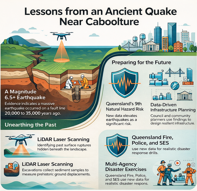
Mapping the past to prepare for the future
The project uses LiDAR, a laser-based mapping system, to scan the landscape and detect subtle changes in the ground that point to past earthquakes. These scans help identify where the earth’s surface may have split during earlier seismic activity and where similar breaks could occur again.
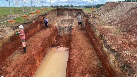
Scientists then dug trenches across the fault line to examine layers of soil and sediment. This tells what has been shifted or left undisturbed, so that the experts can estimate when the earthquake occurred, how strong it was and how far the ground moved. This process, often described by researchers as geological detective work, helps build a clearer picture of earthquake risks in the region.


Findings from these tests are now being analysed, with results expected to confirm earlier mapping and refine estimates of the quake’s timing and size.
Where the fault runs
Geological mapping helps show where the fault sits in relation to the Caboolture district and the North Pine Dam area.
The first map, from the Caboolture 1:100,000 Geology Map Compilation 2014, covers places named on the extract, including Caboolture, Bracalba and Bellmere. The second map, from the Esk 1:100,000 Geology Map Compilation 2014, covers the North Pine Dam, Mount Samson and Clear Mountain area.
These maps do not prove the age or size of a single earthquake on their own, but they do help locals see where mapped fault traces run across the landscape and how those traces relate to surrounding rock and sediment units. It can add to the understanding of why scientists are focusing on this part of South East Queensland.


Understanding the risks for growing communities
While earthquakes are less common in Queensland than in other parts of the world, they are still considered a natural hazard. State-level risk assessments place earthquakes among the lower-tier risks, but experts warn that even a moderate event can cause serious damage, especially in growing urban areas.
Local officials say understanding the Caboolture fault will help guide future planning decisions, including how infrastructure is built and how emergency services respond. The data is also being shared with agencies such as the Queensland Fire Department and utility providers to improve preparedness.
No written history, but a geological record
Because the earthquake occurred long before recorded history, there are no human accounts of the event. Instead, the story is preserved in the land itself through fault scarps and disturbed sediment layers.
National data from Geoscience Australia shows that hundreds of similar features exist across the country, each marking evidence of prehistoric earthquakes. These features are key to understanding where future seismic activity may occur.
In South East Queensland, several fault scarps have been identified in recent years, reinforcing the need for ongoing research in areas not traditionally known for earthquakes.
Building a clearer risk picture
Researchers involved in the Caboolture study say combining mapping, trenching and dating techniques allows them to create realistic scenarios of how a future earthquake might unfold. This includes modelling ground movement, potential damage zones and the likely impact on infrastructure.
This information is valuable in shaping building standards, land-use planning and disaster response strategies. It also supports long-term efforts to ensure communities are better prepared for low-frequency but high-impact events.
Published 15-April-2026
Featured Image Credit: City of Moreton Bay
CLICK ANY LOGO TO SEE PUBLICATION

