




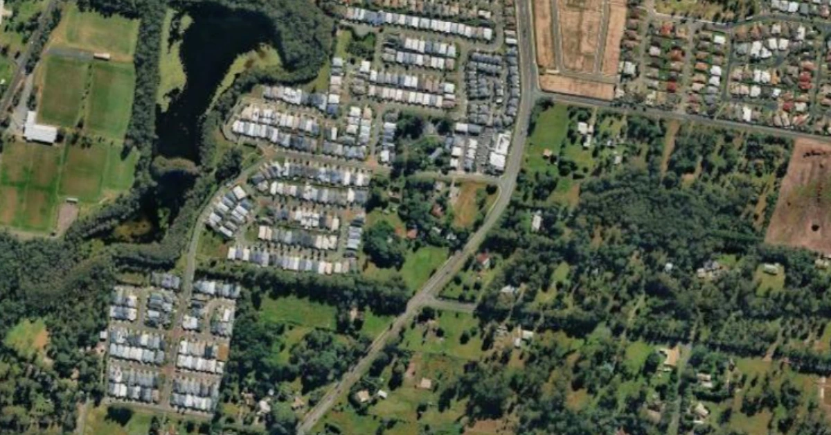
Morayfield South is preparing for a major population increase, with a newly adopted planning framework setting out how the growing suburb could eventually accommodate 26,000 residents and about 9,800 homes.
Read: Morayfield Housing Development Moves Ahead On Oakey Flat Road
The City of Moreton Bay’s second-largest greenfield growth area has reached an important planning milestone, with amendments to its planning scheme taking effect on November 2. The changes introduce a structure plan identifying where future roads, schools, shopping centres, parks, and community facilities could be located.


Covering approximately 900 hectares of predominantly rural residential land in the southern part of Morayfield, the emerging community area has been earmarked for urban growth since 2016. Its development will form part of the City’s longer-term strategy to accommodate a population expected to reach one million over the next 30 years.
Schools, parks, and neighbourhood centres mapped out
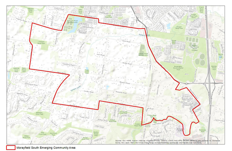
The Morayfield South Structure Plan provides a framework for how the area could develop as new residential neighbourhoods take shape.


Its provisions include locations for four future state school sites, comprising three primary schools and one secondary school. The Queensland Department of Education will be responsible for planning and delivering the future schools, with their timing requiring further consideration.
Two local centres are also identified to serve the growing population. Each is designed around a catchment of 10,000 to 15,000 people and would typically include a full-line supermarket, providing for everyday shopping and services closer to residential areas.
The plan also identifies four locations for community facilities and four future district recreation parks. These are intended to provide spaces for community activities, sport and recreation as the new neighbourhoods develop.
Transport and environmental considerations also feature in the framework. Proposed road improvements and off-road shared pathways are intended to connect residential areas with schools, parks and local shops.


Environmental corridors form another significant part of the plan. The updated mapping provides for approximately 360 hectares of land to be protected for environmental purposes, up from 335 hectares under the previous interim structure plan.
Morayfield South at a glance
Source: City of Moreton Bay planning information. Figures represent long-term planning provisions and estimates.
Years of planning lead to new framework
Morayfield South was included in the emerging community zone when the City’s 2016 planning scheme commenced. Increasing development pressure prompted the introduction of temporary planning controls in 2021 while longer-term arrangements were developed.
Early engagement on the draft structure plan took place in September and October 2023. A formal public consultation period followed from October 13 to November 7, 2025, allowing residents and other stakeholders to comment on the proposed changes.
The Queensland Planning Minister approved the amendment for adoption on October 2, 2026. The City formally adopted the major planning amendment on October 28, with the updated Version 9 of the planning scheme commencing on November 2.
Read: New Childcare Centre Proposed Beside Future School Site in Morayfield
The amendment also addresses building requirements in designated bushfire-prone areas across Moreton Bay, alongside administrative changes to the planning scheme.
Infrastructure delivery remains a future step
Although the structure plan identifies where important infrastructure and community facilities could be located, it does not mean every project is ready for construction.
Further detailed planning is required to determine the specific types, timing and design of community facilities. The City has also not published a consolidated construction timetable for the roads, schools, parks and other infrastructure identified across the growth area.
The distinction is important as Morayfield South moves towards accommodating a much larger population. The planning framework provides direction for future development, while the delivery of services and facilities will depend on further planning and decisions by the relevant authorities.
The adopted structure plan is available through the City of Moreton Bay’s planning information, giving residents an opportunity to examine how the emerging community area is expected to take shape over the coming decades.
Published 4-November-2026
CLICK ANY LOGO TO SEE PUBLICATION