



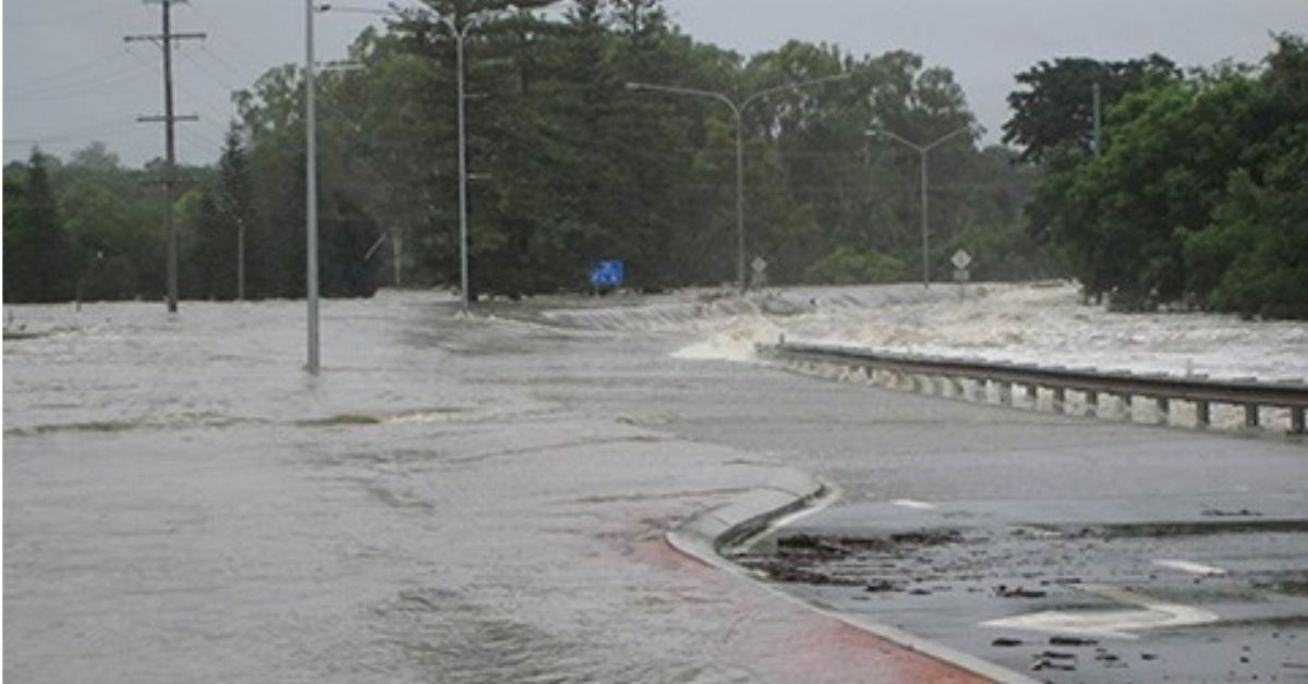
Severe rainfall has renewed scrutiny of Moreton Bay flood infrastructure as local communities grow. However, public records do not show that development caused the flooding or that drainage infrastructure failed.
On Thursday, 22 October, parts of central Moreton Bay received more than 100 millimetres of rain in around three hours. The City of Moreton Bay reported flash flooding and road closures. The event raises questions about how the region plans housing, manages stormwater and prepares for flood risk.


The key question is whether planning decisions and infrastructure investment can keep pace with population growth.
Morayfield South: Planning for future growth
Morayfield South covers about 900 hectares. Council projects that the area could eventually accommodate around 9,800 dwellings and 26,000 people. These figures represent future growth, not existing homes or residents.


The area’s temporary local planning instrument expired on 17 September 2026. Council’s Morayfield South planning information says Council resolved on 22 April 2026 to seek ministerial approval for a proposed planning scheme amendment.
The proposal followed public consultation. It still requires ministerial consideration and a further Council decision on adoption. Council also says some development applications are proceeding under the existing planning scheme.
These distinctions matter. A proposed plan is not an adopted plan. A plan that identifies infrastructure needs also does not confirm that Council has funded, scheduled or built every project.
As Morayfield South grows, planners must coordinate housing with roads, community facilities, environmental protections and stormwater infrastructure. The public records reviewed for this article do not establish that development has caused a specific drainage-capacity shortfall in the area.


Narangba East: Temporary controls guide development
Narangba East also faces important planning decisions. Council adopted Temporary Local Planning Instrument 01/2026 on 17 June 2026. The instrument took effect on 18 June and will remain in place for 24 months unless Council repeals it earlier.
Council’s Narangba East planning instrument explains that the controls restrict incompatible or premature urban development while longer-term planning continues.
The instrument also provides for an early-release area near parts of Old Gympie Road and Richards Road. Suitable business and employment activities may proceed there, subject to planning requirements and approvals.
These controls help guide future development. They do not prove that flood risks have been resolved or that every required infrastructure project is in place.
Planners must assess local flood exposure, drainage paths, environmental constraints and infrastructure timing when considering future development.
Infrastructure plans do not prove delivery
Council’s Local Government Infrastructure Plan Amendment No. 2 took effect on 11 September 2026. It updates trunk infrastructure planning to reflect work undertaken since December 2021.
Council says the amendment also considers updated project costs and long-term financial forecasts. The official infrastructure plan notice outlines these changes.
However, an updated plan does not mean workers have completed every listed project. Nor does it confirm how a particular drainage network performed during extreme rainfall.
Infrastructure plans identify intended networks and projects. Engineers may still need detailed studies, delivery records and site-specific assessments to determine whether a neighbourhood has adequate drainage.
The public documents reviewed for this article do not establish that stormwater infrastructure failed during the 22 October event in Morayfield South, Burpengary East or Narangba East. They also do not establish that planned growth caused the flooding.
What residents can check
Residents concerned about flood exposure can consult Council’s flood mapping and property information. Council provides information on river, creek and urban-drainage flooding, overland flow and storm-tide inundation.
Residents can also seek property-specific flood information from Council. They should check the report for their own address and consider the findings alongside local conditions.
Flood maps help people understand known risks. They cannot guarantee that a property will or will not flood during a particular storm.
Residents also need clear information about planned infrastructure. Which projects will serve each catchment? How will Council fund and schedule them? What stormwater conditions apply to new developments? How will updated modelling account for cumulative growth?
These questions can help residents understand how planners manage future risks. Rainfall totals and population projections alone cannot answer them.
Growth requires coordination, not assumptions
Moreton Bay’s growth will put housing, roads, community facilities, drainage and environmental protection at the centre of local planning.
The October rainfall event gives residents a timely reason to examine how Council plans these systems and communicates flood risks. But the event alone does not prove a planning failure.
To determine whether a specific development or infrastructure gap contributed to flooding, investigators would need evidence about the location, drainage conditions, engineering performance and circumstances of the event.
Current public records show that Moreton Bay is planning for substantial future growth. They also show updated infrastructure arrangements and continuing work on local planning controls.
The next test is how those plans translate into funded projects, completed infrastructure and clear information that helps residents understand their flood risk.
Published 23-October-2026
CLICK ANY LOGO TO SEE PUBLICATION